
Last Updated: November 5, 2026
Quick Summary
Drone survey accuracy improves when you plan flight height and image overlap carefully, place ground control points spread across the site, and check results against independent checkpoints. Lower flights, generous overlap and well-placed, clearly visible markers keep your map in the right place.
- Fly as low as your time and battery allow, and keep overlap high enough for the terrain.
- Spread five to ten ground control points around the perimeter and across the middle of the site.
- Measure each control point properly and record the coordinate system and datum you use.
- Keep two to four measured points aside as checkpoints that are never fed into processing.
- Check height and position separately, since a map can line up horizontally yet drift vertically.
Table of Contents
- Relative and absolute accuracy in drone mapping
- Step 1: Plan Your Flight Height and Image Overlap
- Step 2: Place Ground Control Points Correctly
- Step 3: Choose Between RTK and PPK Positioning
- Step 4: Check Results and Fix Poor Data
- Your Next Step Before the Next Survey Flight
- Frequently Asked Questions
Drone survey accuracy is how close your map or measurement is to the real ground position. For a paddock, a dam wall or a stockpile, that gap decides whether your numbers can be trusted. Many operators get good-looking maps that still give the wrong height or the wrong position. Improving drone survey accuracy is usually simple once you know where the errors come from.
Relative and absolute accuracy in drone mapping
Relative accuracy is how well the parts of your map agree with each other. Absolute accuracy is how well the map matches true coordinates on the ground.
Most farm and site work needs both. If you want site imagery and terrain records from a drone, you can explore drone mapping options for surveying and construction work.
Watch out: a clean-looking map can hide a shifted position. Always check at least a few known points on the ground.
Step 1: Plan Your Flight Height and Image Overlap
Flight height sets how much detail each pixel shows. Lower flights give finer detail but take longer and need more photos. Higher flights cover more ground but blur small features.
Overlap is how much each photo repeats the one before it. Good overlap lets the software match points across images. Too little overlap leaves gaps and weak height data.
Practical steps:
- Pick the lowest height your time and battery will allow.
- Set front overlap and side overlap high enough for the terrain.
- Fly on overcast days or early in the morning to avoid harsh shadows.
Step 2: Place Ground Control Points Correctly
!A farmer in a work shirt and hat kneeling beside a bright orange survey marker in a paddock, a drone resting on the grass in the background under clear morning light
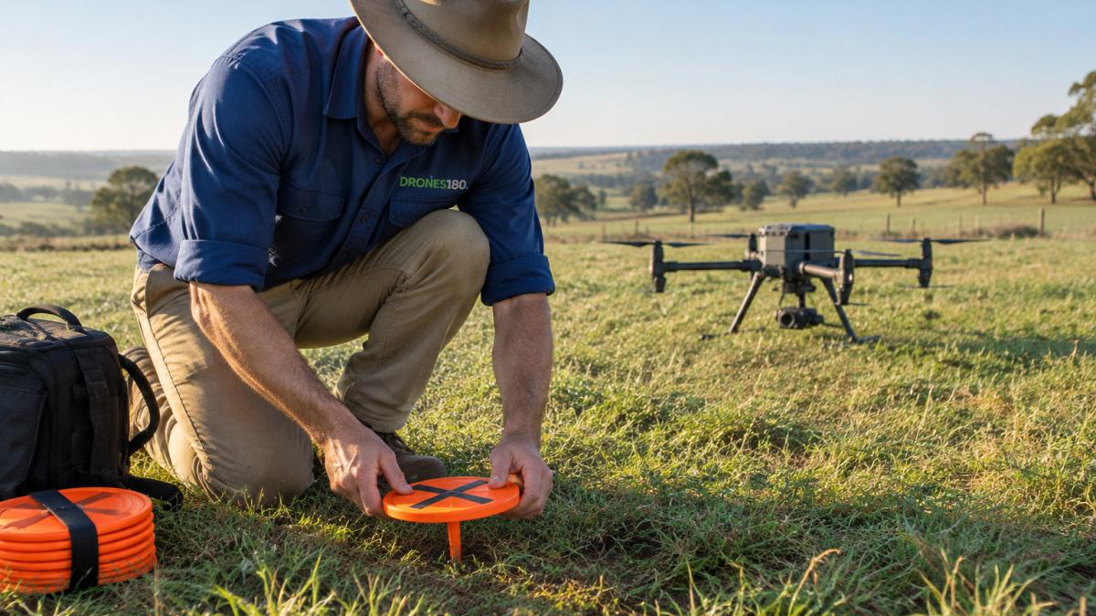
Ground control points (GCPs) are marked spots with known coordinates. The processing software uses them to pull the whole map into the right position. Without them, your map may look sharp but sit in the wrong place, often by several metres, which is enough to put a fence line or a dam wall in the wrong spot.
How many control points you actually need
There is no single correct number, but five to ten well-placed GCPs will often hold a small to medium site to a tight result. Larger or more varied sites usually need more. The number matters less than where they sit. A dozen markers bunched along one fence line will do less for you than six spread evenly across the block.
A workable pattern for a typical paddock:
- Place markers around the perimeter, roughly one per corner and one mid-side.
- Add at least one or two in the middle of the site.
- On sloping or broken ground, add extra points where the elevation changes most.
Make the markers easy to see from the air
Use a high-contrast target, a painted cross, a chequered square, or a commercial fabric marker, large enough to be clearly visible in a photo taken at your flight height. A marker that is only a few pixels wide in the image is hard for the software to centre accurately. Peg them down so wind does not move them between the survey measurement and the flight.
Measure each point properly
A GCP is only as good as the coordinate you give it. Measure each marker with a survey-grade receiver, ideally using RTK or PPK and logging for long enough to get a stable fix. Record the point name, the coordinate, and the coordinate system and datum you are working in, mixing datums between your GCPs and your processing settings is a classic source of a map that is internally consistent but shifted in the real world.
Keep your checkpoints separate
This is the step most people skip. Set aside two to four extra measured points that you do not feed into the processing.
Watch out: a GCP that gets knocked, covered by stock, or measured in the wrong datum will drag the whole map with it, and the error often shows up as a gentle tilt or dome rather than an obvious fault.
Step 3: Choose Between RTK and PPK Positioning
RTK corrects the drone's position during flight using a live signal. PPK records the positions and corrects them after the flight.
RTK is quicker on site. If you need terrain data under trees or scrub, you can see LiDAR mapping for capturing ground that is hard to walk.
Good data starts with the right position method. If you're setting up for repeat surveys, talk to a specialist about equipment that suits your work.
Step 4: Check Results and Fix Poor Data
Checking your map is where most operators either build trust in their numbers or discover they cannot. Do this every flight, not just the first one.
Use your checkpoints as an independent test
Compare the processed map against the checkpoints you measured but did not use in processing. The difference at each checkpoint is your residual error. Look at both the horizontal error (position on the ground) and the vertical error (height), because they often behave differently, a map can be spot-on in position and still drift in height.
Height is usually harder for photogrammetry to pin down than horizontal position, so vertical residuals are often larger. For stockpiles and surface checks on a quarry, you can look at drone workflows for quarries.
Read the error, don't just average it
A single average number hides problems. Look at the spread: are the errors similar across the site, or is one corner badly out? A consistent offset across every checkpoint usually points to a datum, coordinate system, or unit mismatch. A localised error points to a problem in that part of the flight, weak overlap, a bad control point, or poor imagery.
Symptom-to-cause guide
- Map looks domed or bowed in the middle. Usually too few control points in the centre, or all your GCPs sitting around the edges. Add interior control and re-process.
- Edges of the map drift or curl. Often weak side overlap at the boundary, or the aircraft turning before the camera settled. Increase overlap and allow a buffer around your area of interest.
- Blurred or smeared patches. Motion blur from flying too fast for the light, or wind buffeting the drone. Slow down, shoot in better light, or fly on a calmer day.
Fix the cause, then fly again
When a check fails, resist the urge to nudge numbers until they look right. Correct the underlying cause, add control, raise overlap, re-measure a marker, fix the datum, and fly the site again. For a step-by-step look at checking volumetric results on a mine site, read how to run a volumetric analysis.
Watch out: a map that agrees with its own control points proves nothing about real-world accuracy, only independent checkpoints do.
Your Next Step Before the Next Survey Flight
Good accuracy comes from planning, marking your ground points and checking your results every time. Start with one site, follow the steps above, and compare your checkpoints. If you are not sure which system suits your survey, you can answer five quick questions to see matched options. With a few flights, you'll know exactly what your setup can deliver.
Frequently Asked Questions
How accurate can a drone survey be?
A drone survey can reach centimetre-level accuracy when it uses RTK or PPK positioning and well-placed ground control points. Without those, accuracy is usually measured in metres. Relative accuracy, which is how consistent the data is within the survey, is often better than absolute accuracy, which is how close the data sits to real-world coordinates. Check your accuracy by comparing the survey against points you have measured independently on the ground before you rely on the results.
How many ground control points do I need for a drone survey?
The number depends on the size and shape of the site, and how much height change there is across it. Spread points across the corners and centre of the area, and include some at different elevations. Keep a few points back as checkpoints so you can test the results without using them to correct the data. If you use RTK or PPK, you may need fewer ground control points, but checkpoints are still worth measuring to confirm accuracy.
How much overlap should I use for a drone survey?
Flying with high front and side overlap means each point on the ground appears in several photos. Higher overlap gives the processing software more matches to work with, which usually improves the result. Overlap settings should be chosen with your flight height and camera in mind, and tested on a small trial area before a full job. Check the output for gaps or distortion and adjust the settings if you see any.
Do RTK or PPK drones need ground control points?
RTK and PPK drones can work with fewer ground control points because they record accurate positions for each photo. However, ground control points are still useful as checkpoints to confirm the survey is accurate. Without any ground check, you have no independent way to test the results, so measuring a few points on the ground is a sensible step even with RTK or PPK positioning.
If you're not sure which drone setup fits your work, answer five quick questions on our Find My Drone page to see suitable DJI AGRAS and Enterprise systems. For a deeper walkthrough of checking results, read our guide to running a drone volumetric analysis on a mine site.
